| Identification / पहचान | |
| Reference Number / संदर्भ संख्या | TN03001423 |
| Built Heritage/Site निर्मित धरोहर / स्थल |
Built Heritage |
| Name of the Monument / Built Heritage / Site स्मारक / निर्मित धरोहर / स्थल का नाम |
Kilaiy Locality Kiloy Kilay Locality |
| State / राज्य | Tamil Nadu |
| District / जिला | Kancheepuram |
| Manual District | |
| Sub District / उप-जिला | Mangadu (TP) |
| Manual Sub District | |
| Village / गाँव | |
| Manual Village | |
| Cultural Affiliation / सांस्कृतिक सम्बंधन | Prehistoric - प्रागैतिहासिक काल |
| Date/Period तारीख/युग |
C. 9th - 10th Cent. CE |
| Sub Period | |
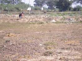
| Geo-Location / भू-अवस्थिति | The site is currently being quarried, and is located en route from the main road to the village of Kilaiy. It is located to the west of the gully, behind the high school to the left of the road. |
| Latitude / अक्षांश | 12 58 54 |
| Longitude / देशान्तर | 79 56 8 |
| Approach to the Monument / पहुंचने का मार्ग | |
| Approach /पहुंचने का मार्ग | N.A |
| Air Port / विमानपत्तन | Chennai |
| Railway Station / रेलवे स्टेशन | Sriperumbudur |
| Bus Station / बस स्टैंड | Kilaiy |
| Topographical Features / स्थलाकृतिक विशेषताएं | |
| Topographical Feature / स्थलाकृतिक विशेषताएं | Plain- मैदान |
| Topographical Description / स्थलाकृतिक विवरण | The site of moderately weathred moderately buried pediplain. The site has a gully cutting through it. |
| History / इतिहास | |
| Brief History / संक्षिप्त इतिहास | This site was surveyed by Pappu et al. 2010a,b,c 2011 |
| Local / Traditional description associated with Built Heritage / Site निर्मित धरोहर / स्थल से सम्बंधित स्थानीय/ परम्परागत विवरण |
Not Applicable |
| Architectural Style / स्थापत्य शैली | N.A - उपलब्ध नहीं |
| Building/ Structure/Site
इमारत / संरचना / स्थल |
|
| Description of Building/ Structure/Site
इमारत/संरचना/स्थल का विवरण |
A ferriocrete gravel lag constitutes the artefact horizon. This overlies around 1.9 m of silty sands with occassional pebbles, which in turn rest on shales. Late Palaeolithic artefacts were collected from the ferricrete gravel. Artefact density is high, around around 4 m , over an area of around 200 x 200 m. |
| Structure material and other material संरचनागत सामग्री और अन्य घटक |
|
| Building/Structure material and other material used प्रयोग में लाई गई इमारती / संरचनागत सामग्री और अन्य घटक |
Not Applicable |
| Usage(s) & Sub Type | |
| Usage(s) / प्रयोग | N.A - उपलब्ध नहीं |
| Sub-Usage(s)/ उप-प्रयोग | Waste land |
| Ownership / स्वामित्व | N.A - उपलब्ध नहीं |
| Protection status / संरक्षण अवस्था | Unprotected- असंरक्षित |
| Plan/Elevation विन्यास/उध्र्व विन्यास | |
| Published Reference / प्रकाशित संदर्भ | |
| Author / लेखक | Pappu, S., A. Kumar, S. Ravindranath and Uday Raj |
| Name / नाम | A Forgotten Heritage Impact Assessment Studies at Prehistoric Sites in Tamil Nadu, in Space Time and Place Proceedings of the III International Conference on Remote Sensing in Archaeology |
| Year / वर्ष | |
| Published/Unpublished प्रकाशित / अप्रकाशित |
Published |
| © Disclaimer:NMMA may be contacted for any further information. The documented data is under correction and subject to validation. |