

| Identification / पहचान | |
| Reference Number / संदर्भ संख्या | DL05012057 |
| Built Heritage/Site निर्मित धरोहर / स्थल |
Site |
| Name of the Monument / Built Heritage / Site स्मारक / निर्मित धरोहर / स्थल का नाम |
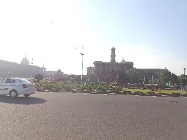
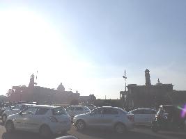
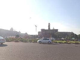
Central Vista, Rajpath |
| State / राज्य | Delhi |
| District / जिला | New Delhi |
| Manual District | |
| Sub District / उप-जिला | |
| Manual Sub District | |
| Village / गाँव | |
| Manual Village | |
| Cultural Affiliation / सांस्कृतिक सम्बंधन | Colonial - औपनिवेशिककाल |
| Date/Period तारीख/युग |
C. 20th Cent. CE |
| Sub Period | 1931 C.E. |
| Geo-Location / भू-अवस्थिति | Lutyens New Delhi |
| Latitude / अक्षांश | 28 36 48 |
| Longitude / देशान्तर | 77 13 62 |
| Approach to the Monument / पहुंचने का मार्ग | |
| Approach /पहुंचने का मार्ग | Approx. 800 m from Central Secretariat Metro Station |
| Air Port / विमानपत्तन | Indira Gandhi International Airport |
| Railway Station / रेलवे स्टेशन | New Delhi Railway Station |
| Bus Station / बस स्टैंड | Rail Bhawan Metro Station Bus Stop |
| Topographical Features / स्थलाकृतिक विशेषताएं | |
| Topographical Feature / स्थलाकृतिक विशेषताएं | Hill - पहाड़ी |
| Topographical Description / स्थलाकृतिक विवरण | It lies in area between flood plains of Yamuna and Delhi Ridge. Delhi Ridge is northern extension of ancient Aravali range. The structure is situated on Raisina hills which is a part of ancient Aravali range. |
| History / इतिहास | |
| Brief History / संक्षिप्त इतिहास | The foundation stone of Imperial Delhi was laid by King George V, during the Delhi Durbar of 1911. The plan for New Delhi was finalized in 1913 and it took nearly twenty years to build an imperial city from scratch. Sir Edwin Lutyens was the prime architect of Imperial Delhi. Delhi was inaugurated by viceroy Lord Irwin on February 13th,1931 as the capital of India. |
| Local / Traditional description associated with Built Heritage / Site निर्मित धरोहर / स्थल से सम्बंधित स्थानीय/ परम्परागत विवरण |
The central axis was the core element of the Lutyens plan of the imperial city. It was supposed to connect the viceroys house to the Old Fort Purana Qila but it would not materialised, as Lady Willingdon insisted on creating the amphitheatre which is now known as National Stadium between the war memorial arch and fort. Finally central axis was named as Kingsway and made to connect the viceroy s house Now Rashtrapati bhavan and war memorial arch now known as India Gate . Now this axis is known as Rajpath. |
| Architectural Style / स्थापत्य शैली | N.A - उपलब्ध नहीं |
| Building/ Structure/Site
इमारत / संरचना / स्थल |
|
| Description of Building/ Structure/Site
इमारत/संरचना/स्थल का विवरण |
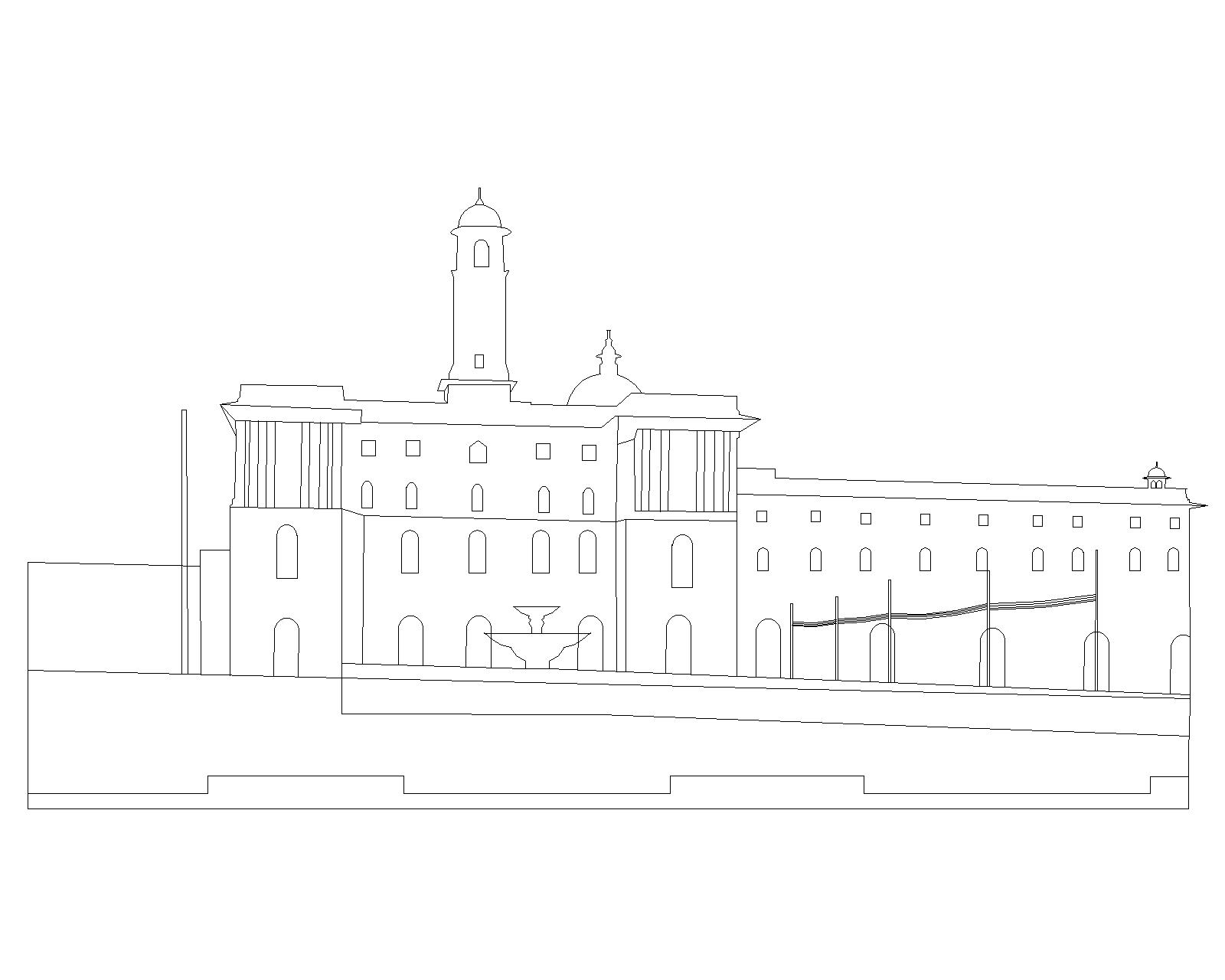
The central vista presents a charming imperial composition of various architectural marvel. It encompasses the area around the imperial central axis. Vijay Chowk earlier known as Viceroy s square marks the beginning of Rajpath. Now Rajpath is the site of Republic day Parade and Vijay Chowk is the place where the Beating the Retreat ceremony is held every year to conclude the Republic Day celebration. The imperial avenue that is Rajpath is lined on both sides by pleasing huge lawns, canals fountains and lush green trees. The tree plantation in and around the central vista was planned with all the care by William Robert to highlight the imperial architecture marvels around and enhance the glory of imperial city of New Delhi. |
| Structure material and other material संरचनागत सामग्री और अन्य घटक |
|
| Building/Structure material and other material used प्रयोग में लाई गई इमारती / संरचनागत सामग्री और अन्य घटक |
It is made up of Buff and red sandstone. |
| Usage(s) & Sub Type | |
| Usage(s) / प्रयोग | Living Monument - प्रयोग |
| Sub-Usage(s)/ उप-प्रयोग | |
| Ownership / स्वामित्व | Central - केन्द्र |
| Protection status / संरक्षण अवस्था | Centrallly Protected - केन्द्र संरक्षित |
| Plan/Elevation विन्यास/उध्र्व विन्यास |
|
| Published Reference / प्रकाशित संदर्भ | |
| Author / लेखक | INTACH |
| Name / नाम | Delhi The Built Heritage, INTACH Delhi Chapter, 1999-2000, vol-1, pg-192 |
| Year / वर्ष | 1999-2000 |
| Published/Unpublished प्रकाशित / अप्रकाशित |
Published |
| © Disclaimer:NMMA may be contacted for any further information. The documented data is under correction and subject to validation. |