| Identification / पहचान | |
| Reference Number / संदर्भ संख्या | TN01001395 |
| Built Heritage/Site निर्मित धरोहर / स्थल |
Built Heritage |
| Name of the Monument / Built Heritage / Site स्मारक / निर्मित धरोहर / स्थल का नाम |
Bommajikonam Bommajikolam |
| State / राज्य | Tamil Nadu |
| District / जिला | Thiruvallur |
| Manual District | |
| Sub District / उप-जिला | Gummidipoondi (TP) |
| Manual Sub District | |
| Village / गाँव | |
| Manual Village | |
| Cultural Affiliation / सांस्कृतिक सम्बंधन | Prehistoric - प्रागैतिहासिक काल |
| Date/Period तारीख/युग |
C. 9th - 10th Cent. CE |
| Sub Period | |
| Geo-Location / भू-अवस्थिति | This locality is situated along the road leading to Bommajikonam village from off the Kaveripettai-Satyavedu highway. |
| Latitude / अक्षांश | 13 25 7 |
| Longitude / देशान्तर | 79 58 58 |
| Approach to the Monument / पहुंचने का मार्ग | |
| Approach /पहुंचने का मार्ग | N.A |
| Air Port / विमानपत्तन | Chennai |
| Railway Station / रेलवे स्टेशन | Gummidipoondi |
| Bus Station / बस स्टैंड | Bommajikonam |
| Topographical Features / स्थलाकृतिक विशेषताएं | |
| Topographical Feature / स्थलाकृतिक विशेषताएं | Plain- मैदान |
| Topographical Description / स्थलाकृतिक विवरण | The geomorphological feature is that of a weathered buried pediplain. |
| History / इतिहास | |
| Brief History / संक्षिप्त इतिहास | This site was explored by Prehistory Branch of ASI and Atlas Branch IAR 1966-67 20 , Swami 1976 and Pappu et al. 2010a,b,c 2011 . |
| Local / Traditional description associated with Built Heritage / Site निर्मित धरोहर / स्थल से सम्बंधित स्थानीय/ परम्परागत विवरण |
Not Applicable |
| Architectural Style / स्थापत्य शैली | N.A - उपलब्ध नहीं |
| Building/ Structure/Site
इमारत / संरचना / स्थल |
|
| Description of Building/ Structure/Site
इमारत/संरचना/स्थल का विवरण |
Differentially eroded reddish-brown sands 10 YR 7 4 and 10 R6 6 , disconformably overlying the ferricrete gravel, they are archaeologically sterile and heavily eroded. These were seen elsewhere in the vicintiy of the site. The artefact context is that of an indurated ferricrete gravel with occassional patches of duricrust with embedded artefacts and cobbles. These overlie a Cenozoic laterite profile. A very high density of artefacts were noted within the small areas of exposed duricrust. |
| Structure material and other material संरचनागत सामग्री और अन्य घटक |
|
| Building/Structure material and other material used प्रयोग में लाई गई इमारती / संरचनागत सामग्री और अन्य घटक |
Not Applicable |
| Usage(s) & Sub Type | |
| Usage(s) / प्रयोग | N.A - उपलब्ध नहीं |
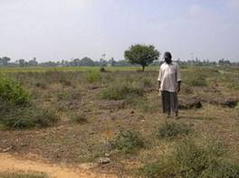
| Sub-Usage(s)/ उप-प्रयोग | Burial ground surrounded by agricultural fields |
| Ownership / स्वामित्व | N.A - उपलब्ध नहीं |
| Protection status / संरक्षण अवस्था | Unprotected- असंरक्षित |
| Plan/Elevation विन्यास/उध्र्व विन्यास | |
| Published Reference / प्रकाशित संदर्भ | |
| Author / लेखक | Pappu, S., A. Kumar, S. Ravindranath and Uday Raj |
| Name / नाम | Exploration in District Chingleput done by Prehistory Branch of ASI |
| Year / वर्ष | |
| Published/Unpublished प्रकाशित / अप्रकाशित |
Published |
| © Disclaimer:NMMA may be contacted for any further information. The documented data is under correction and subject to validation. |